Where Is Galata Tower? Location & District
Where Is Galata Tower?
Galata Tower stands on the European side of Istanbul, on a hilltop in the Beyoğlu district, just north of the Golden Horn and directly above the waterfront neighborhood of Karaköy. If you are trying to picture it on a map: draw a line from the historic Old City (Sultanahmet) across the water, and the tower is the tall cylindrical landmark rising on the opposite hillside.
Because it sits on high ground and towers over the low rooftops around it, Galata Tower is one of the easiest landmarks in Istanbul to spot — and one of the easiest to navigate toward.
Location at a Glance
| Detail | Information |
|---|---|
| City | Istanbul, Turkey |
| Continent side | European side |
| District (ilçe) | Beyoğlu |
| Quarter | Galata |
| Neighborhood (mahalle) | Bereketzade |
| Sits above | Karaköy, north shore of the Golden Horn |
| Coordinates | 41.0256° N, 28.9744° E |
| Elevation | Hilltop, ~140 m above sea level |
| Tower height | ~66.9 m (≈67 m), 9 floors |
| Full address | Bereketzade Mah., Galata Kulesi Sk., 34421 Beyoğlu, İstanbul |
European Side, North of the Golden Horn
Istanbul is split by water into distinct parts. The Bosphorus Strait divides the European and Asian sides, while the Golden Horn (Haliç) — an inlet off the Bosphorus — separates the historic peninsula from the northern districts.
Galata Tower sits firmly on the European side, on the northern bank of the Golden Horn. This puts it in the same part of the city as Taksim, İstiklal Avenue, and the modern cultural district of Beyoğlu. The Asian side, with neighborhoods like Kadıköy and Üsküdar, lies across the Bosphorus to the east — nowhere near the tower.
The District: Beyoğlu, Galata, Bereketzade
Administratively, the tower belongs to the Beyoğlu district (ilçe), one of the most central and pedestrian-friendly parts of Istanbul. Within Beyoğlu, it stands in the historic Galata quarter — a steep, atmospheric neighborhood of narrow cobbled streets that was a walled Genoese trading colony in the Middle Ages. The precise administrative unit is the Bereketzade neighborhood (mahalle).
The Genoese built the tower here in 1348 as Christea Turris — the "Tower of Christ" — as the high point of their fortified colony. It reopened as a museum under the Ministry of Culture and Tourism in 2020. That medieval history is why the tower crowns the hilltop: it was designed to survey the harbor and the approaches to the colony.
Orientation: Sultanahmet, Karaköy, and Taksim
Understanding what surrounds the tower makes it far easier to find:
- Karaköy (downhill, south): The waterfront district directly below the tower. This is where the ferries dock and where the T1 tram runs. From the water, you look up the hill to see the tower.
- Sultanahmet / the Old City (across the water, south): The historic peninsula with Hagia Sophia and the Blue Mosque lies across the Golden Horn. You reach it by crossing the Galata Bridge — about a 25–30 minute walk, or a short tram ride.
- Taksim & İstiklal Avenue (uphill, north): Head up the hill from the tower and you reach the buzzing heart of modern Beyoğlu in roughly 15 minutes on foot along İstiklal Avenue.
So the tower sits at the pivot point between the historic Old City below and the modern city above — one of the reasons it is such a natural stop on any Istanbul itinerary.
How to Spot It
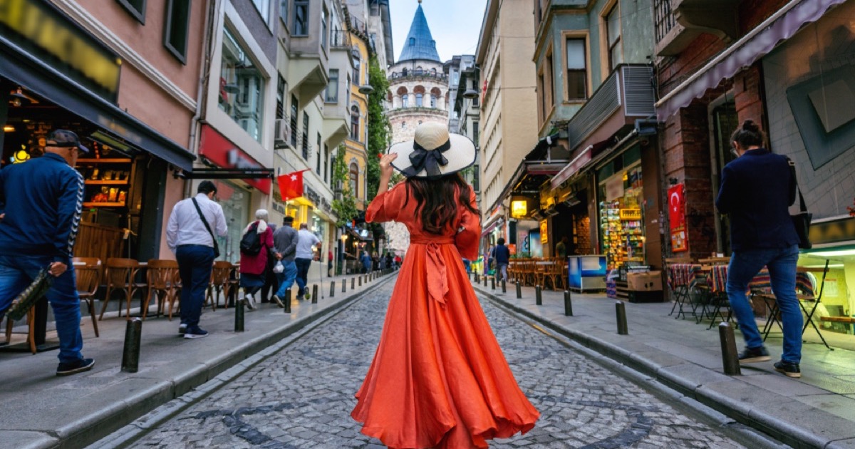
Galata Tower is a tall, cylindrical stone tower topped with a pointed conical grey roof, standing about 67 metres tall on a hilltop that is itself around 140 metres above sea level. Because it rises well above the surrounding rooftops, you can see it from:
- The Galata Bridge and the Eminönü waterfront
- Ferries crossing the Golden Horn and the Bosphorus
- Much of the Sultanahmet skyline across the water
- Many rooftop terraces throughout Beyoğlu and Karaköy
When walking in Galata, the simplest strategy is to keep heading uphill — the streets naturally funnel toward the tower at the crown of the hill.
Distances & Walking Times to Nearby Landmarks
| From / To | Approx. distance | On foot |
|---|---|---|
| Karaköy waterfront & ferries | ~500 m | ~10 min uphill |
| Şişhane M2 metro station | ~400 m | ~5 min |
| Galata Bridge | ~600 m | ~10 min |
| İstiklal Avenue (lower end) | ~350 m | ~5 min |
| Taksim Square | ~1.2 km | ~15 min uphill |
| Sultanahmet (Old City) | ~1.8 km | ~25–30 min via Galata Bridge |
Getting There (In Brief)
The tower is well connected. The nearest metro is Şişhane (M2), about a 5-minute walk. Karaköy — served by the T1 tram and multiple ferry lines — is roughly a 10-minute walk uphill. The historic Tünel funicular links Karaköy with the lower end of İstiklal, and from Taksim it is about a 15-minute stroll down İstiklal Avenue. For full transit directions, routes, and tips, see our dedicated Getting There guide.
Plan Your Visit
Now that you know where the tower is, plan the rest of your trip. Check current prices and how to buy on our Tickets page, see what you'll find on each of the nine floors in our Inside the Tower guide, and browse common visitor questions on the FAQ page. For step-by-step transport directions, head to Getting There.
Good to know: Galata Tower is open every day, 08:30–23:00 (last admission 22:00), and the standard 2026 adult ticket is ₺650 (~$30 / ~€28).
Address & Contact
Address: Bereketzade Mahallesi, Galata Kulesi Sokak, 34421 Beyoğlu, İstanbul, Türkiye.
Galata Tower is a state museum operated by the Turkish Ministry of Culture and Tourism, so there is no private booking office. Official information, current opening hours and online tickets are published on the ministry's museum portal, muze.gov.tr — always treat that as the authoritative source rather than third-party listings, and check it for the latest contact details before you visit. Any map app, taxi driver or ferry captain will recognise "Galata Kulesi" instantly.
Frequently Asked Questions
Where exactly is Galata Tower located?
Galata Tower stands in the Bereketzade neighborhood of the Galata quarter, within the Beyoğlu district of Istanbul. It sits on the European side of the city, on a hilltop just north of the Golden Horn, directly above the waterfront district of Karaköy. Its coordinates are 41.0256° N, 28.9744° E.
Is Galata Tower on the European or Asian side of Istanbul?
Galata Tower is on the European side of Istanbul. It rises above the northern shore of the Golden Horn, on the same continental side as Taksim, Beyoğlu, and İstiklal Avenue. The Asian side of the city lies across the Bosphorus, well to the east.
Which district is Galata Tower in?
Galata Tower is in the Beyoğlu district (ilçe). More specifically it belongs to the historic Galata quarter and the Bereketzade neighborhood (mahalle). Beyoğlu is one of Istanbul's most central and walkable districts, home to Taksim Square and İstiklal Avenue.
What is the full address of Galata Tower?
The tower's address is Bereketzade Mahallesi, Galata Kulesi Sokak, 34421 Beyoğlu, İstanbul, Turkey. Any taxi driver, ferry captain, or map app will recognize 'Galata Kulesi' instantly, as it is one of the most famous landmarks in the city.
How far is Galata Tower from Sultanahmet and Taksim?
Galata Tower sits between the two. Sultanahmet (the Old City) is across the Golden Horn to the south, about a 25–30 minute walk over the Galata Bridge. Taksim Square is uphill to the north, roughly a 15-minute walk up İstiklal Avenue.
How do I recognize Galata Tower from a distance?
Galata Tower is a tall, cylindrical stone tower topped with a conical grey roof, standing about 67 metres high on a hilltop. Because it rises above the low rooftops of Galata, it is visible from the Golden Horn, the Galata Bridge, and much of the Old City skyline.